


chemin de st guilhem le desert

chasle
User
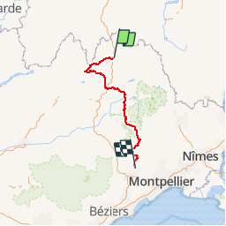

Length
241 km

Max alt
1409 m

Uphill gradient
6509 m
Km-Effort
331 km

Min alt
82 m

Downhill gradient
7455 m
Boucle
No
Creation date :
2018-06-26 15:39:37.699
Updated on :
2018-06-26 15:39:37.699
--
Difficulty : Difficult

FREE GPS app for hiking
 SityTrail
IGN / Geographical institutes
SityTrail Plus
The world is yours!
About
Trail Walking of 241 km to be discovered at Occitania, Lozère, Peyre en Aubrac. This trail is proposed by chasle.
Positioning
Country:
France
Region :
Occitania
Department/Province :
Lozère
Municipality :
Peyre en Aubrac
Location:
Aumont-Aubrac
Start:(Dec)
Start:(UTM)
522306 ; 4951878 (31T) N.
Comments